
Introduction

Project Background
This project seeks to address current gaps in traffic monitoring and complement the existing Traffic Data Analytics System (TDAS) by delivering real-time, precise information on road conditions. Unlike many existing solutions, our platform focuses specifically on minor roads, which often receive limited coverage. By broadening the scope of monitoring and providing accurate, actionable data, the system aims to enhance urban traffic management, bolster road safety, and improve overall mobility within Hong Kong.
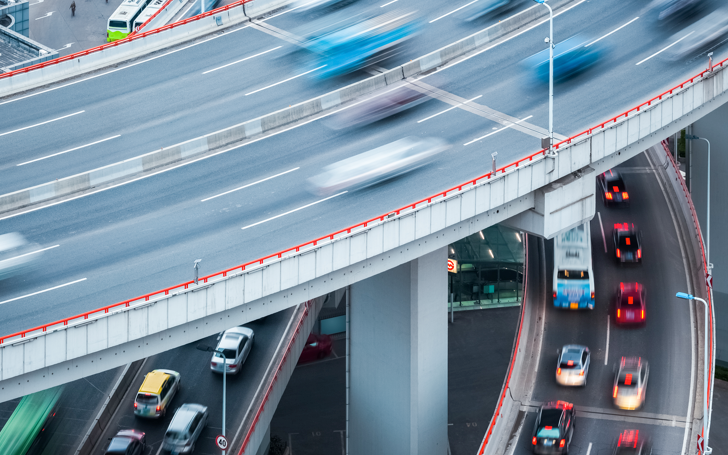
Hong Kong, recognized as one of the most densely populated cities worldwide, faces significant challenges stemming from its high population density and restricted land resources. The substantial rise in on-road vehicles, coupled with limited space for expansion, has led to persistent traffic congestion and mounting safety concerns—issues that urgently require effective solutions. Research continues to emphasize the importance of comprehensive, dynamic urban traffic information to boost transportation efficiency, reduce road accidents, and enable smarter traffic management strategies.
Although existing traffic monitoring tools—such as the HKeMobility application managed by the HKSAR Transport Department—offer valuable insights, they do have limitations. HKeMobility primarily addresses public transport disruptions and scheduled roadwork, providing real-time information through static image snapshots or short video clips. However, extracting meaningful insights from these data formats often demands additional processing. Moreover, the application concentrates on major roads and tunnels, crowdsourcing data on traffic speeds and journey times (up to 90 minutes), yet it does not fully capture conditions on minor roads. Our proposed system intends to fill these gaps by expanding coverage and delivering high-quality, real-time traffic data across Hong Kong.

Project Aims / Objectives
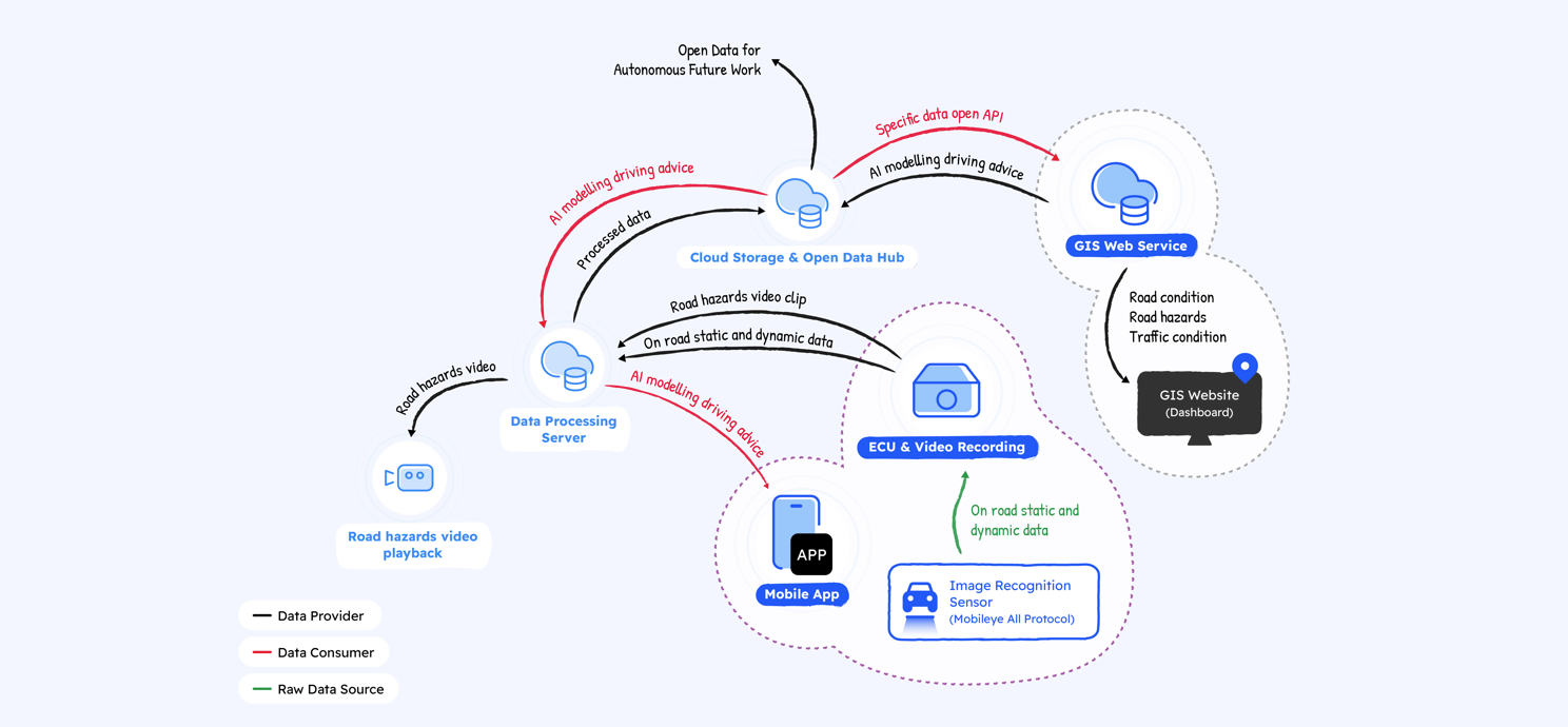
This project seeks to create an advanced, information-driven transport system to improve traffic efficiency and safety in Hong Kong. Using cutting-edge technologies like Artificial Internet of Things (AIoT), autonomous driving, and Geospatial Artificial Intelligence (GeoAI), the system will analyze real-time road and traffic conditions.
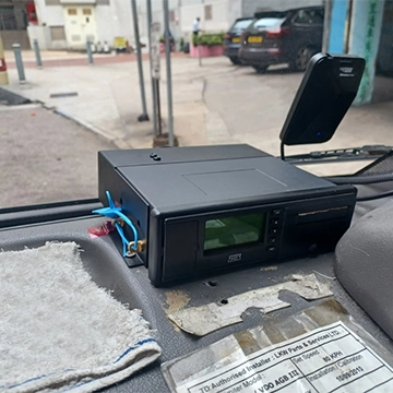

The initiative has two main components: hardware and software. The hardware includes AIoT mobility sensors installed on vehicles, which will conduct road asset surveys, dynamic mapping, and build a comprehensive mobility database. The software component is a GIS-based intelligent transport platform that combines GeoAI capabilities with open geospatial data—such as traffic flow, weather, and environmental conditions—to enable both predictive and responsive traffic management.
Analysis & Modeling
The pilot study will involve 150 vehicles, including minibuses, taxis, and logistic vans, operating in high-priority areas like Kowloon East, where traffic congestion and accidents are most prevalent.
Short-term Goals
- Provide drivers with real-time hazard alerts to enhance road safety and reduce accidents.
Long-term Goals
- Develop a detailed road-traffic information database at the road-segment level.
- Support Hong Kong’s smart mobility initiatives and pave the way for future data-driven infrastructure and autonomous driving solutions, as outlined in the “Smart Mobility Roadmap for Hong Kong.”

This project represents a significant step toward a safer, Informative, and mobile transportation system, fostering smart city equiped with Smart Mobility and Smart Government.
Team Members

Principal Investigator
Prof. Paulina Wong

Co-Principal Investigator
Prof. Man Leung Wong

Co-Principal Investigator
Dr. Ir. Rosiah Ho
Project manager
- Dr. Kester Lee
Research Team
- Dr. Emily Wang
- Ms. Wenhui Cai
- Mr. Anson Yip
- Mr. Benjamin Ng
- Mr. Minhao Li
Collaborations
This project is funded by the Smart Traffic Fund (#PSRI/56/2212/PR). This project is a collaborative effort involving several key partners, each contributing specialized expertise to ensure its success:
Smart Traffic Fund
TUV Rheinland Hong Kong
Ensures product safety, compliance with certifications, and supports promotional activities.
Tech Union Holdings Limited
Supports industrial ICT needs for the project.
Internet Professional Association
Provides advice on ICT solutions, cybersecurity measures, and promotional efforts.
Hong Kong Electronics & Technologies Association
Contributes to hardware design, ICT expertise, and commercialization planning.
Smart City Consortium and IoT HK Association
Focus on project promotion and commercialization strategies.
Jump Intelligence Group Limited
Offers guidance on utilizing Smart Lamppost open data and supports project promotion.
Public Light Bus General Association
Assists with vehicle recruitment, pilot testing, promotion, and commercialization.
